2021-2023
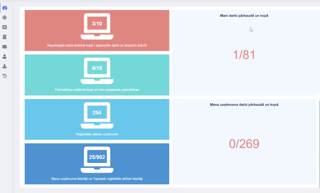
Geographic data management platform. METRUM’s subsidiary company developed the pgis.lv and tergis.lv system, within which it is possible to accumulate, display and publish geospatial data.
2021-2022
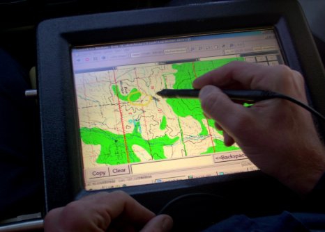
Highly detailed topographic information inspection software. METRUM’s subsidiary company developed the topoweb.lv system, within which it is possible to use ADTI information verification at five levels – territorial ownership of data, comparison of data with VZD information, verification of compliance of data with specifications, logical verification of data, comparison of data with archive materials.
Purpose: A platform for checking and maintaining highly detailed topographical information
Finds/specifies/deletes illegal layer names
Automatically corrects line, text and path errors
Fixes ‘IsAnnotation’ value for cells, texts, lines (based on VZD letter) enabling file browsing/editing at scales 1:250, 1:500 and 1:1000 with functionality built into the free CAD program file provided by VZD
No line type restrictions (based on VZD letter)
No text type restrictions (based on VZD letter)
Result: platform topoweb.lv
2019-2020
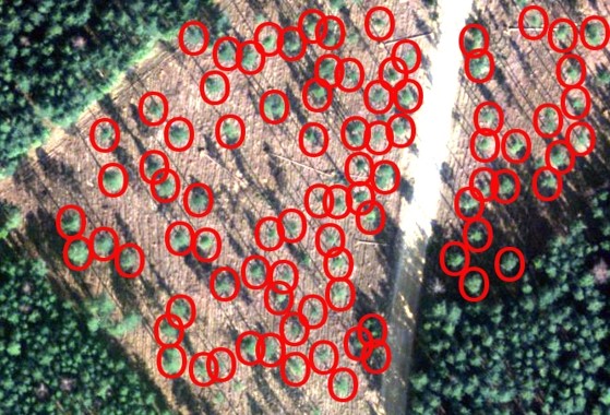
Analysis of hyperspectral data using Sentiel satellite images. METRUM’s subsidiary company developed the kmi.lv system, within which it is possible to use Sentinel data.
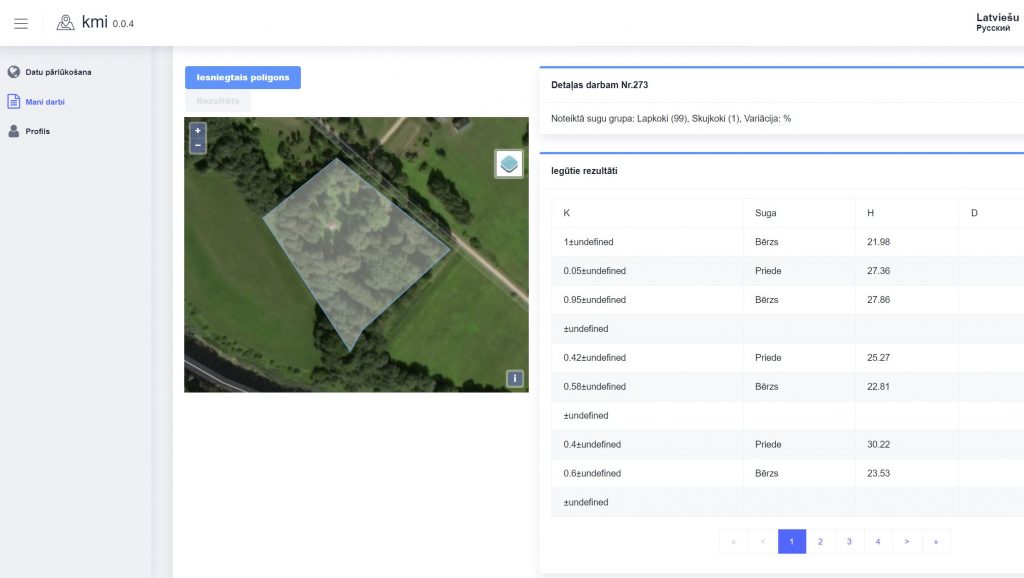
Purpose: Identifying species is one of the most important tasks, the results of which depend on all further activities and results of forest management planning. The studies carried out so far show that the implementation of this task using remote sensing data is problematic and that the obtained results are not sufficiently accurate to be able to solve planning tasks based only on this information. As part of the European Space Agency’s “Copernicus” program, the Sentinel-2a and Sentinel-2b satellites were launched in 2015 and 2017, which provide high-resolution multispectral image acquisition, and one of the purposes of their use is the observation of vegetation, soil, water bodies and marine territories. Sentinel satellites acquire images with a resolution (pixel projection size on the ground) from 10 to 60 m and 12 channels, the frequency of image acquisition for one satellite is 10 days, so using data from both satellites, it is possible to survey one area every 5 days (rarely taking account for clouds). Previous studies on the use of remote sensing data show that the best results of species detection are obtained when working with multispectral images, however, although the results obtained in the studies are quite good, their practical use is limited by data availability and acquisition options, which could be solved using easily available Sentinel data.
Result: kmi.lv platform
2015-2016
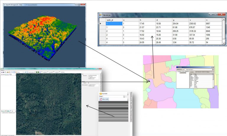
Analysis of hyperspectral data. LLU ERAF Hyperspectral data analysis, EUR 450,000 project. SIA METRUM co-financing EUR 32,000. Tree species recognition using hyperspectral data. Technology for remote sensing of forest taxonomy data (AMT technology) using hyperspectral sensor and aerial laser scanning data.
Purpose: To develop a new technology for remote determination of forest tax data, which can be integrated into the forest inventory process using hyperspectral sensor and aerial laser scanning data.
Result: Algorithms for data processing and forecasting assortments.
2014-2015
LIDAR KMI improvement: MNKC project 2014/2015, Funding agreement No. 4-02/P11, 4-06/53-P11, 1-06/19. The total amount of the project is EUR 264,868, support is EUR 159,599. SIA METRUM investment is EUR 105,269. To evaluate the possibilities of using LIDAR and aerial photo data for more effective forest management planning and to conduct a study of the possibilities of using the “LIDAR KMI” method in the preparation of the felling stock and forecasting the results of assortments.
To evaluate the possibility of using the LIDAR KMI method in the preparation of the felling stock and forecasting the results of assortments. To evaluate the possibilities of using LIDAR and aerial photo data for more efficient forest management planning. Development of mathematical algorithms.
Principles/algorithm of determining the sample plot algorithm, methodology
2013-2014
Improving the basic algorithm of LIDAR BMI. Russian pilot project 2013/2014. Methodology development – for determining input parameters. Costs 92,000,000 RUB (2013 exchange rate EUR 210,000). A contract with a Russian company to conduct research in the territory of Veliky Novgorod.
Principles/algorithm of determining the sample plot algorithm, methodology
2009-2011
LIDAR KMI – the beginnings of data application. “Development of SIA METRUM new forest inventory technology” – Project development – 2009-2011. (Priority 2.1 “Science and innovations”, measure 2.1.2 “Innovations”, activity 2.1.2.2 “Development of new products and technologies”, sub-activity 2.1.2.2.1 “Development of new products and technologies”) Project application number : JPI/2.1.2.2.1/09/01/024, project contract number: L-JPI-09-0073. The total amount of the contract – 881,324 lats (without VAT), respectively EUR 1,254,011. Co-financing from the ERDF fund – 288,302 lats, respectively EUR 410,217. In total, SIA METRUM invested EUR 843,794 in research and product development. A total of 43,026 working hours were invested in the research.
The new technology will solve the main problems of forest taxation – subjectivity of the assessor, execution time, consumption of human resources, costs. The goal of the project is to develop a fundamentally new forest inventory technology, where data collection is ensured with the help of a specially equipped aircraft, only by flying over the object of interest, while the analysis of the collected data is provided with the help of specialized software.
In order to do this, first of all, an industrial study will be conducted and new knowledge and techniques will be obtained, on the basis of which the second part of the project – the experimental development of the software – will be implemented.
The successful implementation of the project will be ensured by the participation of scientists from the Latvian Agricultural University. The computer program contains data flow algorithms and calculations for collecting equal parameters for given plot sizes, a method for data collection and calculations.
2007-2009
METRUM wins the 3rd place in the competition “Export and Innovation Award 2009.” On November 4, 2019, in the framework of the 2nd round of the Most Innovative Product competition category, “Metrum” presented to the LIAA commission the creation of airfield obstacle maps using the laser scanning method, which is a novelty worldwide. At the moment, “Metrum” is the only company in Eurasia that has prepared a scheme of technical solutions in order to be able to carry out the survey, inventory and mapping of objects dangerous to air navigation in the vicinity of the airfield, in compliance with the requirements of Annexes 14 and 15 of the International Civil Aviation Convention.
Purpose: Development of airport obstacle maps, development of methodology, using the latest possible methods – LIDAR and aerial photo data.
The result: the use of LIDAR technology in the development of aeronautical maps. The methodology was introduced and later applied in the surveying of all airports in Kazakhstan. Partly in Armenia, Lithuania and Latvia.
2005-2006
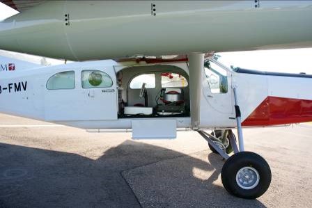
METER | a multidisciplinary company with the aim of providing qualitative and innovative solutions in surveying, territory planning, obtaining geospatial information. METRUM started its active operation in the Latvian market in 2005, bringing together experienced and professional surveying, territory planning and geospatial information specialists in the company. Laser scanning and aerial photography equipment, Pilatus PC6 aircraft were purchased.
In 2005, we introduced the newest type – hitherto unused in Latvia – ADS type camera for obtaining aerial photos, the main difference is that the pictures are taken similarly to scanning – when one picture is up to 20 kilometers long. Difference from Frame (frame) cameras, data processing speed and quality in forest area.