In order to plan the location of the wind farm as quickly and efficiently as possible, ways to assess their potential visual impact on the landscape should be provided already in the planning process of wind farms, which is emphasized as an important factor in order to obtain public support for the construction of wind farms in a specific location.
Subjectively assessing the visual impact of wind farms from local planning, detailed planning, photomontages, etc. two-dimensional materials, neither the overall volume of the wind farm nor the visual changes of a specific viewpoint can be captured. A static photograph, in which a model of a wind farm is digitally placed, is unable to provide information about the spatiality of the landscape, which is necessary in the development of quality landscape models, and is also unable to depict, for example, the movement of the rotor of a power plant.
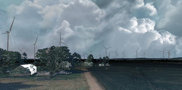
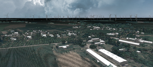
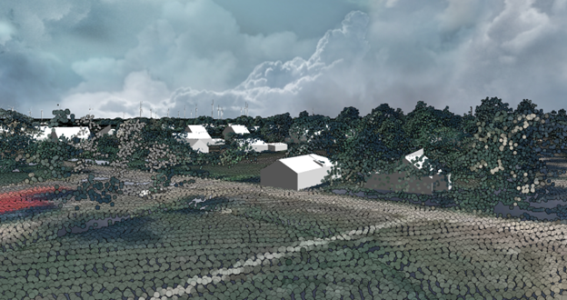
We are preparing a digital augmented reality 3D model for the wind park area, including the adjacent areas that the planned park will potentially affect. In the era of three-dimensional (3D) modeling, free access resources and remote solutions, it is possible to create geospatially linked wind farm models that can be used for higher quality, and at the same time more reliable, visual modeling of landscapes in the wind farm planning process. The 3D model includes the location of wind power plants in real, planned volumes, according to the project submitted by the customer, as well as the elements of the area – buildings, roads, agricultural land areas, forest massifs, which are represented in real sizes.
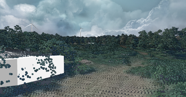
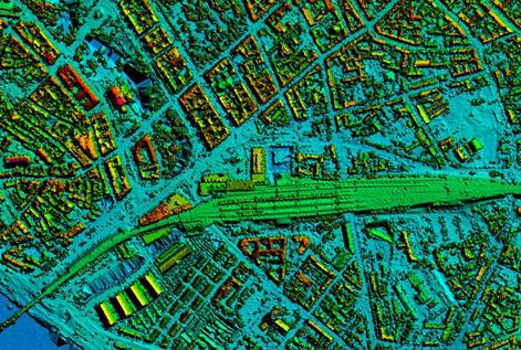
Using data from open-access LiDAR point clouds and orthophoto maps of the Latvian Geospatial Information Agency, the vegetation data of the territory is created. The terrain model is created from LiDAR data, connected to the corresponding orthophoto maps in a 3D modeling program. The program also creates building models from a combination of freely available cadastre and building outline data and LiDAR data, as well as adapting a freely available wind power plant model, scaling it and developing an animation for it.
By combining the possibilities of open access programs with appropriate, freely available data, we create an interactive 3D reality model with wind power plants as visual influencers of the landscape, both locally usable and serviceable. It is possible to use the 3D model in the environmental impact assessment process, in the assessment of the impact on the landscape, as well as in the development of a local plan or detailed plan.
Reviews
There are no reviews yet.